This is the Maryhill Museum. It sits on the Washington bank of the Columbia River in middle of nowhere. There are literally no buildings within sight of this 'house'. That's what it was built to be by Samuel Hill, a man with an obsession over two women. Sadly for his marriage, neither one was his wife. Yes, this place is as huge as it looks. In the reviews I read about this place, it's described as 'eclectic' and 'eccentric'. I would also add unexpected and creepy.


Meet Loie Fuller. A nice mid-western girl, only able to speak pigeon French, who overnight became a dance sensation at the Follies Bergere in Paris at the turn of the century. She was lionized by the press and became an instant European and American celebrity. Her talent? She devised a series of dance steps involving voluminous gowns she swirled about herself using rods and dowels to twirl the material. She must have had 'something' because she managed to keep herself in the limelight for the next 30 years becoming the darling of the rich and powerful. One of her conquests was the American entrepreneur, Sam Hill. Sam, the builder of the above house was her lifelong friend. The house, now the Maryhill Museum, contains photographs of her, posters advertising her run at the Follies, paintings, bronze medals struck with her likeness, the above statue, and a 1906 Pathe Company movie of Loie doing her dance routine. She must have been compelling because she was friends with royalty, multi-millionaires, great artists (Rodin), and scientists (Marie Curie). With Sam, she raised millions of dollars for post WWI European relief. All fame is fleeting...nobody today remembers her at all.
Entering the mansion you are confronted with bizarre furniture, clothing and accessories. Behold Sam Hill's second lady: Queen Marie of Romania.
Here she is surrounded by her children. She is a relation of Queen Victoria (like who wasn't in European Royalty in 1900). Somehow she and Sam Hill developed a relationship. In the house she urged him to turn into a museum, I saw the coronation gown she wore to the crowning of Czar Nicolas II, two thrones, her crown, as well as various pieces of jewelry and trinkets designed and executed by Faberge. The gown and mantle were the most fascinating. I think it's less the material (woven with gold threads and embroidered with silver accented by rhinestones) as much as the 18" waistline.
(No, she didn't wear tennis shoes under her coronation gown; those are my feet. A trick of the reflection.)
The entire time I was in these exhibits, I kept wondering about the relationships between this wealthy man and these two women. The all knew each other. That much is obvious from the pictures scattered around the museum. I couldn't decide is he was with them consecutively or concurrently. I suspect he and Loie were the love match. She never married. I think the Queen and him became friends rather than intimates during his herculean effort to raise money for European relief after World War I. Without the efforts of wealthy and influential men and women, a significant portion of the European population would have starved to death in 1919.
After reading about his personal history (very hidden; you had to find the small print), I don't begrudge him the happiness he found. It turns out that his wife didn't like the West, and she didn't like either Oregon or Washington at all. She whisked herself back to the Midwest taking their two small children with her. The small print allows that they were 'estranged'. I had to wonder - before or after Loie and the Queen? Even sadder, Sam's two children: his daughter developed paranoid schizophrenia, and his son totally rejected him and refused to communicate with his father. There were certainly volumes not disclosed in the few short paragraphs I was able to find.
If this wasn't enough, the excellent portion of this museum took me totally by surprise. Down in the basement was gathered an amazing collection of Native American artifacts from every portion of North America once inhabited solely by Indians.
I saw the Smithsonian Museum of Native America when I was in New York, and the Maryhill Museum collection was equally impressive. Not only were there artifacts of significance, but they were beautifully presented together with amazing early photographs of vanishing people. Here's my favorite one:
Tlinglit Basketmakers in Sitka, 1895 - baskets were already being made for tourists. I couldn't resist taking pictures of the various artifacts that appealed to me as either unique or outstanding examples.
Finally, Sam Hill was certain this area was destined to become a major economic player in the United States. He gambled buying thousands of acres and trying to lure 'settlers' to immigrate and make his vision a reality. He had enough pull to get a major bridge built across the Columbia within spitting distance of his new house. Who knows why this didn't happen? Perhaps the 10" of annual rainfall stunted agriculture which he envisioned as the economic lynch pin of his dream. Perhaps he was diverted by the two women with whom he was obviously obsessed. Or perhaps he lost heart after World War I as did so many others of that generation. He left a mysteriously haunting museum which I'm glad I saw.
If you want to see more pictures of the Columbia Gorge as well as Sam's museum, click the link:
https://picasaweb.google.com/jalyss1/2012OregonColumbiaRiverGorge?authkey=Gv1sRgCMrKo63Lv9SSqgE
We headed for Portland, Oregon. As we move from place to place, we have discovered generally you can travel one of two routes. We have learned to choose the non-Interstate route when possible since we are the slowest vehicle on the road. Additionally, the 18 wheelers own the Interstates, and when they travel in packs, it's pretty darn intimidating. The second route is usually the old two lane plodding farm road through every tiny town that survived the 19th and 20th centuries. We plod right along with the old pick up trucks, tractors, and often some piece of baffling farm machinery lumbering down these roads.

One of the things I have learned on this trip is the importance of a river. People learned thousands of years ago if you want to go anywhere of significant distance west of the Mississippi, you'd better use a river, and you'd better find a pass over mountains that are thousands of feet high. The power and importance of the Snake River and its tributaries, and the Columbia River and its tributaries still dominate the land. Almost every significant road we have driven in the past month followed every curve of one river or another. It doesn't take much imagination to visualize the canoes traveling the West. This impression has been facilitated because we have followed a significant portion of the 200+ year old route of Meriwether Lewis and William Clark. Their mission as stated directly by Thomas Jefferson was to find a navigable water route across the continent to open trade with Asia.
Land transportation routes in the West were laid down first by deer, elk and bears, widened by Native Americans, used by covered wagons, covered with railroad tracks by the Manifest Destiny crowd, and paved with concrete and asphalt in the first half of the 20th century to accommodate the gasoline powered engine.
As we drove along the north shore of the Columbia River on Highway 14, a dandy scenic two lane Washington state highway, I realized that I was watching more than a thousand years of human history roll by. Look at this picture: There's the Columbia River on the left, and right beside it is a railroad track (just happened to catch a passing train), and you can see the road on the right side of the picture. This history illustrating triumvirate rolled on mile after mile.
While the river is efficient for long stretches, you don't have to read too far in the Lewis/Clark journals to hear about the 'portages'. For the unknowing, a portage is where you climb out of the canoe, shoulder everything you're carrying in the canoe, then pick up the canoe and carry it and everything else to the next section of navigable river. This happened FREQUENTLY and portages could be a hop, skip and a jump, or long grueling miles. The long and short of it is that for the purposes of major commerce traveling by river is limited and not very efficient.
The land trails that usually ran beside the rivers were narrow strips of dirt. Great for animals, OK for slow individual human progress, but again, you don't have to read many pioneer covered wagon journals before the horrors of crossing rivers and going over mountains is detailed often by counting the dead.
The Hiawatha Bike Trail, with its tunnels and trestles made us realize the effort it took to carve a railroad over and through the mountains. We got to see the "Golden Spike" area of Utah where the first rail line joining the East and West met. WOW! I finally understood not only the economic significance, but also the psychological impact two strips of steel laid over squared trees had on the commerce and psyche of America.
This trip was a graphically visual lesson of transportation in America and its evolution. The rivers introduced Europeans to the grandeur and almost unimaginable resources which must have seemed free for the taking. The railroads decided which towns lived or died, rang the final death knell of the nomadic Plains Indian culture by facilitating killing off the buffalo, and standardized many elements of everyday life. The time zones that we live by are a consequence of the railroads.
The roads which followed the rails allowed everyman to move himself, his goods, his services and his family anywhere in this country. Truckers criss cross this country on multi-lane high speed highways. All this coordinated, accessible transportation would seem like magic to Lewis and Clark. Those same roads are allowing us to have this marvelous adventure. It's just plain ironic and humbling that these roads we whiz over are following so many footsteps before us.
When I was fooling around looking for stuff to do this month in Montana and Idaho, I ran across the Hiawatha Bike Trail. Normally, these 'bike trails' are designed for hard bodies that are at least 40 years younger than I am. It was a real surprise to discover this trail was COMPLETELY DOWNHILL. I couldn't believe it! Even I can do downhill. This is a rail to trail deal. Basically, that means that an abandoned railway is converted to a bike trail by taking up the steel rails and 'tracks'. That leaves a graded road bed which usually has a slope of less than 2% - especially in the mountains. No one wants to see a runaway train. You ride downhill, and at a certain point, a shuttle bus (actually yellow school bus) takes you back to your car.
Drake, of course, was all excited; he's been looking forward to this day for months. I was finally reassured that I could do this when the geezer (he had to be at least 10 years older than ME) who drove the Red Bus in Glacier told me he had done the ride and it was fun. He was totally right.
The trail we did is 12 miles long. We opted NOT to do the one and two-thirds mile tunnel just before the Roland Trail Head which is after the big tunnel. Doing the St. Paul Tunnel would have lengthened the ride to about 15 miles. Turned out to be a very smart decision on our part because we discovered in a 648 foot tunnel later in the ride that our bike lights were totally inadequate. I saw what I'm doing for bike lights in the future. A couple of women had strapped 9 volt flashlights on their handlebars - now those will conquer a tunnel. Tunnels, it turns out, are quite scary when you get into utter darkness and can't see light from either end. That happened to us for about 30 feet in one tunnel. It was creepy.
Trestles, on the other hand, are absolutely exhilarating. They are like riding across a two lane bridge; but when you look out, you see the tops of conifers. Some of the trestles were a couple of hundred feet high, and the views over the trees was breathtaking. That is what I was looking forward to, and I wasn't disappointed.
The real bike riders ride the Hiawatha Trail UPHILL for 15 miles then turn around and ride it downhill. Those would be the 'hard bodies' I referred to above. All kinds of people are on the trail. There was one family with a five year old in her helmet pedaling her 16" bicycle. Even downhill was going to be a big ride for her. There were groups of college students, and some oldsters like us. There was one group of women who had included one of their moms. She was riding her three wheeler and carrying picnic lunches for everyone. This trail was bumpy in that it's gravel and embedded stones. Our hybrid tires were OK, but there was one couple with ultra thin racing tires. They must have been excellent riders because I would have been spilled off in the first 100 feet.
The trail was like a dirt road, and in some sections like a dirt road with washboards. My hands and arms are tired from the constant shaking. One smart thing we did was to both get new hybrid bikes which have suspension on the seat post and on the handlebar post. Man did we need that extra suspension. A woman getting on the shuttle bus back to our cars was really complaining about how bad her hands were hurting after riding her 'old' bike with no suspension on it. Her husband was just ignoring her; I guess she was a complainer in real life.
We ended this day with lunch in historic Wallace, Idaho. I've been in many, many towns who preface their name with 'historic', but in the case of Wallace, it's the only town in America which is entirely in the National Register of Historic Places. It's a turn of the century mining town with all of their downtown business buildings preserved as well as their homes. The lady at the tourist information center told us they registered building after building to defeat Interstate 90 from demolishing the town. When they finished, they had registered every major building and home in town, and I-90 had to be moved.
I also talked to a guy who sold me a piece of silver, lead, copper and quartz ore. I didn't 'pick it up', but it is from one of the mines around Wallace. Silver is still being mined here today. Interestingly, lead is lovely in it's raw form and silver is ugly. When they are refined, it's just the opposite. We had lunch in the 1313 Saloon, and a milkshake from the Red Garage. Everywhere you look in town there are unique architectural details. I tried to capture some of them in the photos
The pictures are bang up this time, with more info about the trail and the town.
https://picasaweb.google.com/jalyss1/2012DriveToIdahoHiawathaBikeTrail?authkey=Gv1sRgCKO5_PHPsozUFg
 We are leaving the third of three National Parks. First, the Grand Tetons which I liked least, then Yellowstone which was unique, and finally, Glacier which is my favorite. The reason I like Glacier best is that the scenery was overwhelming. This is ONE of dozens of pictures I just casually snapped all over the park.
Second, there's a road here mostly built during the Great Depression which is hewn from a mountain, and goes over Logan Pass.
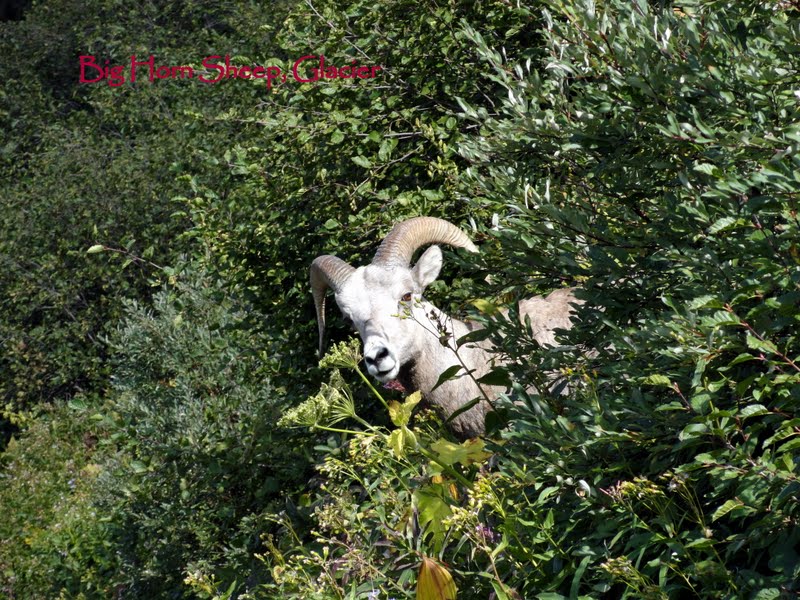
Third, we saw real wildlife here up close. Drake got to not only see a bear; he got to see a bear and cubs. We also got to see a Big Horn Sheep, who politely waited for us to pass by, so he could resume walking on his trail.
Fourth, I hiked the best trail EVER. The High Line Trail here starts at Logan Pass and you hike along the rim of a mountain. The above picture was snapped on that hike.
Fifth, there were actually still some very lovely alpine wildflowers throughout the park and especially on the trail. As we all know, I never met a flower whose picture I didn't take.
 Sixth, I got to ride in a 1936 touring car on the Road to the Sun through Logan Pass with interesting historical commentary by the driver. Example: The US government coerced the Blackfoot Indian Tribe to sell 1 million acres (Glacier National Park) to it for $1.5 million dollars. Most of the Blackfeet people still regard this as a lease rather than an outright sale, and until the 1940's had hunting and fishing rights in the park. They had one chief at the time who had authority to make the deal, and the tribe was so incensed at his acquiescence, they changed their governmental form to a council as a result of his signature on the sale/lease.


Seventh, I got to see a 1915 hotel (Many Glaciers) still in operation nestled among the mountains and fronting a turquo lake. This was the other side of Logan Pass, and it took us almost 3 hours to drive over from the west side of the park. This is the bear hang out of the park - fewer people over here - and sure enough, Drake got to see a real bear.
He had just given up after panning the slopes for bears with the binoculars. He was pretty discouraged, and just as we were leaving the area we saw a knot of about 30 people standing beside the road. Now, on our third park, we know this means that someone has spotted SOMETHING. In Yellowstone we saw bison and elk, but we were hoping for a bear sighting here. We saw not just a bear, but a bear and 2 cubs from about 25 yards away (with a Ranger in attendance). The is the mom bear, cub pictures below in the link.
Eighth, the condo we rented here was absolutely lovely. It had a big flat screen television, a nice kitchen filled with excellent appliances, and good linens. It was in the middle of a connifer forest, and we saw wild turkeys and deer on our way to the park each morning.
Ninth, the weather was what we were hoping and expecting. The Grand Tetons were covered in smoke from wildfires. Yellowstone was just downright hot - mid to upper 80's. Glacier was just right - nippy in the morning, and balmy 70's in the afternoons. It was perfect hiking weather.
I did learn that there are really TWO Glacier National Parks - the east and west sides connnected by Logan Pass. They have totally different topography, as well as different ecosystems. We saw mostly the west side this time with a quick day trip over to the east. We didn't see the Canadian Waterton Park, and there is much more hiking here that is accessible to me. This is the park I would love to see in June or July when the wildflowers are blooming. We will probably try to see the Canadian part of the park next time and stay in the quaint hotel on the east side.
The pictures this time really are spectacular. Enjoy.
https://picasaweb.google.com/jalyss1/2012GlacierNationalPark?authkey=Gv1sRgCOfvibGLpeefcg
Everyone loves Yellowstone, and when I say EVERYONE, I mean the world. I could chronicle all the natural wonders of this park, many of which are iconic to America. The quintessential being Old Faithful which immediately conjures up a mental image to any American over the age of 8. More fascinating than the natural wonders were the numbers of people from all over the world which we encountered this week.
My favorites: The Scottish cowboys. I had used up my steps for the day, so Larry, Susi and Drake decided to do one more short hike. I brought out my embroidery (always a conversation starter), sat down on a bench created from a log, and watched the world march by. Back to my cowboys. I looked up and four men, of a certain age, (that's about my age) were walking toward me wearing authentic looking 19th century cowboy garb. Initially, I thought they were some 'entertainment' provided by the park - perhaps some living history performance. I let them pass by.
However, my curiosity got the better of me, and I stopped them on the way back from the canyon overlook attraction, and asked why they were dressed up. It turns out this was a 3 week vacation they had planned for a year. They assembled their own costumes replicating 19th century apparel: hats, shirts, pants, and accessories. They flew here from Scotland and worked a 19th century round up, gathering cattle on horseback, castrating calves, using holes they dug for their latrines, eating off the back of the chuck wagon, and sleeping in bedrolls on the ground. I asked them if they prepared physically for the experience, and they laughed saying they discussed getting physically ready at the pub, but somehow they didn't get around to it. As one guy put it, the first few days getting off the horse after an entire day in the saddle was excruciatingly painful. They radiated excitement and delight with their cowboy experience. The words tumbled out they were so deliriously happy to share with me how they felt. Each one had totally embraced the experience, even though, they confided, their wives (back in Scotland) were not thrilled with this undertaking. How were they spending the last few days of their trip? Visiting the natural wonders of Yellowstone.
A few minutes later, a pair of Italian women came by, and talked to me in Italian about embroidery. The ladies knew one English word: "Beautiful." They pointed out each of the stitches I was using and told me the name of the stitch in Italian while I repeated them in English. We had a very pleasant 5 minute conversation, and the finale? Their admiration of the awesome sights of Yellowstone which they expressed with elaborate hand gestures.
When the Italian ladies departed, a young Japanese girl (about age 10) and her mother sat down. The little girl spoke fairly good English and she was the translator between myself and her mother - who wanted to know where in America I was from. She knew "Texas". Again, we had a translated conversation about the sights.
Next, two sisters, one of whom was already a doctor in Bangladesh, and the other who was working on her PhD in computer science at Syracuse University sat down. They had walked a trail, and sent their husbands down the road to get the car; they didn't have any more energy. They both expressed the awe they felt at the scenery not only at Yellowstone, but also just crossing the country by car. The immenseness of the continent impressed both of them. They both absolutely loved the United States.
There were busloads of Chinese tourists. Most of them didn't speak any English, or a very few words, but they were unfailingly polite. The same could be said for the Japanese tourist busloads. My observation was that the Japanese groups were more exuberant than the Chinese. The Chinese groups seemed a little tense and overwhelmed, perhaps a result of EVERYTHING being so foreign. I'm sure I would be a bit tense in China.
While we were waiting for Old Faithful to erupt, I just sat on the bench and listened: Within earshot there were at least five languages being spoken besides English. When OF finally blew, no words were needed - everyone just went, "AHHHH".
One of the ways I enjoyed interacting with people at Yellowstone was offering to take pictures of couples with some attraction in the background. Invariably, in the exchange of cameras we would fall into chitchat. The first topic if they were American, was, "Where are you from?" To a person, when we said, "Texas", they invariably told us their brother, cousin, nephew, next door neighbor's daughter, or someone they knew lived in ___________, Texas. Did we know where that was? It happened every time.
We discovered that every wait person in the restaurants was from a foreign country: We were waited on by Bulgarians, Poles, Russians, Ukrainians, and a couple of other countries I can't remember. Apparently, lots of college students come over to Yellowstone, get jobs for the summer, practice their English, and then go back to college in their native country when the summer season is over. It seems like a hard way to improve your command of English.
If you want to see the wonders of Yellowstone and can't make the trip, I did you the favor of taking 500 pictures. For those of you who just love the pictures, Yellowstone will not disappoint.
https://picasaweb.google.com/jalyss1/2012YellowstoneNationalPark?authkey=Gv1sRgCNThqY_P_aj3owE#
The Grand Tetons should have been grand, and they weren't. First, smoke literally did get into my eyes from the Idaho wildfires. A week of WSW winds obscured what must surely be one of the most panoramic vistas in America. There were three major fires in central Idaho which were below 10% contained, and the firefighters did not expect containment until October. Logan and every other town north up through the Tetons are putting up with a significant haze of smoke. The pictures I took were from the 'good day' of the four days we spent in Jackson Hole, Wyoming.
Talk about a town that leaves a bad taste. The first thing we noticed was 'rush hour' - long streams of cars coming into town in the morning and the same long streams exiting town in the afternoon. They were all going to small towns up to 30 miles away from Jackson on twisting mountain roads making these peoples' commute as bad as any big metropolitan route. I concluded that people who actually work for a living can't afford housing in the town they work in. I had heard this was the case in Vail, Colorado, and my observation is that Jackson, Wyoming is pulling the same stunt.
Oh, I'm told, "Jackson is so picturesque, and a source of jobs in an area where jobs are few and far between." I will give the picturesque point - the elk antler archways over the corners of the park comprising the town square were charming. However, a service job selling overpriced merchandise, waiting on tables, pumping gas, and working a convenience store are not careers and barely pay a living wage. And if that's not bad enough; lots of those jobs are summer only. Since we have been touring the West, we have run into people who have two jobs hundreds of miles apart: Some tourist town in the summer, and another high season tourist town in the winter. As we have talked to people at restaurants, in shops, at parks, while pumping gas, we have heard the same refrain: Real people can no longer afford to live in Wyoming and parts of Montana; the rich people own all the land, most of which they neglect or underuse. We've run into many bitter Wyoming transplants living elsewhere due to economic necessity.
I enjoyed the privileged class' museum calling itself "The National Museum of Wildlife Art". I never found anywhere that substantiated the 'national' claim. I'm pretty sure it is self designated. To be fair, the building was magnificent, and the art collected ranged from mostly mediocre paintings surrounded by first rate western sculpture portraying various animals of the far West. The sculptures range from table sized to full sized and oversized.
If I sound lukewarm about this destination, I suppose it's because we had just toured an area that was supporting their own real history. The people in the town of Cloverfield in Idaho all got together, raised the money themselves, and built the Oregon/California Trail Museum since their town was a popular stop along the trail, and is how it came into being. The entire town raised the money and built the museum, so they could preserve the actual 19th century camping site of the wagon trains. Then, they devised a unique living history experience for the visitors with volunteers from the town. Jackson's National Wildlife Art Museum came across as slick and disingenuous in comparison.
I did find one thing to recommend Jackson: Snake River beer. This is a micro brew making some of the best beer I've tasted in quite a long time. The Snake River Lager was superb as was the Pale Ale. I've been disappointed not to find it around Yellowstone. Instead I'm stuck with Moose Drool, which if you can get past the disgusting name, isn't too bad.
I was glad to leave Jackson, although we lucked out on the accommodations there - comfortable with great beds and every detail attended to prior to our arrival. The Grand Teton Park was nice, and as always - photos
https://picasaweb.google.com/jalyss1/2012GrandTetonsNationalPark?authkey=Gv1sRgCIWl2L_Pm8rQcw#
Within five hours of crossing into Idaho, we realized we had left the straight-laced, obsessively cheerful, clean living, Mormon dominated culture and had returned to a more wide open society which openly tolerates more points of view and differing life styles. I think it was the combination tattoo parlor, coffee shop and head shop with it's cheerful neon that clinched the deal. for me

 Southern Idaho did hold many surprises starting with the Snake River. Now, the Snake River is to Idaho and Wyoming as the Trinity is to central Texas or the Mississippi is to Louisiana. I just didn't expect it to come with its own deep canyon. We arrived in Twin Falls by crossing the Perrine Bridge, named for Ira Perrine the first guy to utilize the Snake River Aquifer to enhance agriculture. Southern Idaho is the location of the famous Idaho potato. I was thrilled to see potatoes being harvested and cleaned right in the field. Ok, Ok, so it doesn't take much to entertain me, but this area is filled with farms, farms, and farms growing alfalfa, potatoes, and soy beans. I know this because we inadvertently toured farm country looking for the Niagra Springs, which Drake is convinced no longer exist.

This area is called The Thousand Springs. Springs sprout from the canyon walls surrounding the Snake River, and also bubble up to support a National Fish Hatchery growing two kinds of trout to offset the trout loss caused by the damming of the Snake River. There are also a series of spring fed spa resorts tapping into springs and converting them into soaking pools. We had two fun afternoons at the Miracle Springs Spa enjoying those pools after a day of touring.
 We packed in the attractions (of course) which made the heated spring fed pools a special treat. Two notable places were the Malad Gorge which was the original route of the Snake River. Millions of years ago, the Snake was re-routed by volcanic action. The other fun place was the National Fish Hatchery where we met a woman whose job is cutting off fish fins. We also saw the Shoshone Falls. This is the site of the big annual Shoshone salmon catch up until the start of the 20th century. The fish were dried and stored and used to get the Shoshone tribes through the winter time. This practice was stopped by the damming of the Snake River. These 200 foot high falls are currently at 'low water' because of the time of the year, but they were big enough to throw up a rainbow when they struck the water. Just as the buffalo kills in the 19th century destroyed the western Native American way of life, the 20th century damming of the western rivers destroyed the salmon runs which were a vital source of food for significant numbers of tribes. Seeing these falls which no longer support salmon, was a mute witness to the end of a culture.
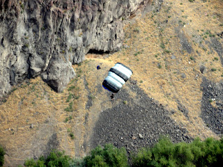 Did I tell you that we both got new bikes? We did a little shake down bike ride on the path bordering the deep Snake River canyon, and we actually saw idiots jumping off the bridge (the bridge in the above picture) with parachutes on their backs. I talked to one of them, and his answer to "Why do you do this?" was "It's fun." Why do adrenaline junkies never recognize their disease? The Australian guy I talked to told me this bridge is famous, and is the only place he knows of in the entire world where you can jump off a public bridge with a parachute on your back. He explained that he started para-sailing, and bungee jumping, moved on to jumping out of planes, and then discovered the fun of jumping off a bridge. Even he admitted that 'night jumps' tended to be really hair raising. The 14 year old girl I was watching this idiocy with couldn't understand why I thought it was so stupid to do this.
Notice how murky my pictures look? No, it's not poor photography - it's smoke. It's been really disappointing to be a tourist in Idaho and Wyoming over the past couple of weeks because of the massive wildfires burning in central Idaho. Southwesterly prevailing winds have been spreading smoke for the past two weeks. We woke up the last week in Logan to discover the crystal clean air looking more like summer air in Fort Worth. The wildfire smoke had arrived. This is very serious. Entire communities have been threatened. One small town has been on the verge of being engulfed by a fire that's only 5% contained for the past week. The smoke isn't expected to dissipate until October when the firefighters estimate the three major fires will be put out. In the meantime, the crappy air has been obscuring the beauty of this area, and messing up the trip. However, acts of God (the fires were caused by lightening) simply have to be tolerated and made the best of by us mortals.
 On to the Craters of the Moon which is a left over lava field from a series of volcanoes that erupted in this area of Idaho millions of years ago. This is a national monument which would have been more impressive if we hadn't been to the Volcano National Park in Hawaii. My favorite part of this little side trip was observing what is the first thing to start growing in this part of the world on the lava and cinders. It's this lichen.
Sometimes when we are on the road, odd stuff just pops up as in Arco, Idaho (the first town to have electricity generated by nuclear power). As we drove into town, a couple of massive mountains dominated the landscape. They were covered with numbers going back to 1920. Each high school class apparently puts their graduation year on the mountain. Weird, but entertaining.
We enjoyed Idaho. I know, I always enjoy all the stuff. We ate fresh trout as well as sturgeon bites, and I'll leave you with a picture from the fish hatchery. These are their pets; five foot long sturgeon in a pool with examples of the rainbow and steel head trout raised at the hatchery.
Southern Idaho was very different than what I expected. It's dominated historically by the end of the Native American culture, and by the wagon trains that moved through the area in the mid 19th century. You can still see the wagon ruts as the trails became completely defined as if they were interstate highways. We saw the Oregon/California Trail museum and visited the City of Rocks, a famous stop over by the trains. The 21st century land is dominated by farming. Acres and waves of corn, hay, soybeans, and potatoes. This seemed more like the Midwest than the far West. The people were friendly, but more contained with a live and let live attitude. Tourism is less of a big deal here than in Wyoming. I got the impression that these people are too busy wringing a living from the land to mess with tourists scouting out the 'attractions'.
As always, the pictures tell more of the story:
https://picasaweb.google.com/jalyss1/2012Idaho?authkey=Gv1sRgCNDP84Xyvp6Rcg#
To tour the City of the Rocks see these pictures:
https://picasaweb.google.com/jalyss1/2012UtahCityOfRocksIdaho?authkey=Gv1sRgCIjE3MSJl_KUiAE#